Backtracking the Oregon Trail

Afterword

462.one lg wagonI hope you’ve enjoyed our journey retracing Martha’s footsteps as we backtracked the Oregon Trail. As noted in the beginning it took us five days to cover the miles that took them five months. We streaked across modern highways in an air-conditioned car. Martha walked all the way, one step at a time. She trudged through fantastic mountain scenery and wide lonely prairies and deserts. I’m sure she embraced nature’s wonders while despairing of the next climb, the uncertainty of water and sustenance, the heat and cold.

It was a thrill to see the places again, some for the first time. Certainly I saw landmarks on this trip with new appreciation.

Returning home by air, I happened to notice the Columbia River below me, somewhere near The Dalles where we met Martha coming the other way.

598.columbia river from airYou can see the blue line cutting through the middle of the photo. The highway—and the Oregon Trail—follow it for some distance on the east side of the Cascades.

Years after her long trek Martha marveled at news of the newly built railroad crossing the country. Could she even imagine flying through the sky? About five hours in the air to go the distance that took her five months? I was happy to get home in less than a full day, rather than five long days on the road.

If you missed any post in this series and would like to find it, go to the right-hand side of the page and scroll down to “Categories.” Click on “Backtracking the Oregon Trail” to find them all listed. (Or just scroll down the main page. There aren’t very many intervening posts.)

Thank you for joining us.

COMMENT

Backtracking the Oregon Trail #4

Day Three ~ Fort Hall

481.Ft Hll exteriorMartha batted away mosquitoes as she sat in the shade with the girls and several other women and children outside the sturdy structure. Fort Hall. What a relief to find this semblance of civilization so far out in the wilderness. It also meant they’d covered a fair amount of their journey, but when she asked Larry if it would be downhill from here, he wouldn’t answer.
A Place of Her Own: The Legacy of Oregon Pioneer Martha Poindexter Maupin, Janet Fisher. (Guilford, CT, Helena, MT: TwoDot/Globe Pequot Press, 2014), p. 118.

July 23rd We traveled 18 miles;;, twelve and a half miles brought us to fort Hall. . . . This fort is built of sun burnt brick (adobes), It is a rather shabby looking concern, but in case of an attak from without its inmates would be tolerably well protected It has port holes through the walls for the admission of guns,; This fort is now abandond by the government and is occupied by some traders;;
—The diary of Abigail Jane Scott, in Covered Wagon Women: Diaries and Letters from the Western Trails, 1840-1890. Vol. 5, 1852, The Oregon Trail, Kenneth L. Holmes and David C. Duniway, eds. (Glendale, CA: The Arthur H. Clark Co., 1986), p. 94.

[August] 19 Thursday To day came to Fort Hall on snake River and passed it at one in the P.M. It is made of unburnt bricks and is little larger than a good sized barn. It is not now occupied by the soldiers but is used for a trading station. Some 50 or 100 wagons, markd U.S. in large letters stand there rotting. Encamped about 2 miles from the fort on Pannock creek and had very good feed – Made 14m
—The diary of Cecelia Adams & Parthenia Blank, in Covered Wagon Women: Diaries and Letters from the Western Trails, 1840-1890. Vol. 5, 1852, The Oregon Trail, Kenneth L. Holmes and David C. Duniway, eds. (Glendale, CA: The Arthur H. Clark Co., 1986), p. 284.

28th Thursday . . . We almost suffered with dust & want of water Near night we came to the Port Neuf river which we had to ford it is large & deep we had to raise our wagon beds. Ft Hall trading post is near . . . The men from the post came to see us . . .
29 Friday Our road was through sage brush . . . The mosquitoes were very annoying.
—The diary of Celinda Hines, in Covered Wagon Women: Diaries and Letters from the Western Trails, 1840-1890. Vol. 6, 1850, Kenneth L. Holmes, ed. (Glendale, CA: The Arthur H. Clark Co., 1986), p. 106.

474.inside ft hallAnd so continued the journey of my daughter and granddaughter and myself as we retraced the footsteps of our Maupin ancestors who traveled west over the Oregon Trail in 1850. Now we were backtracking the trail, heading east on our way to Kansas City, where my daughter was moving to take a new job.

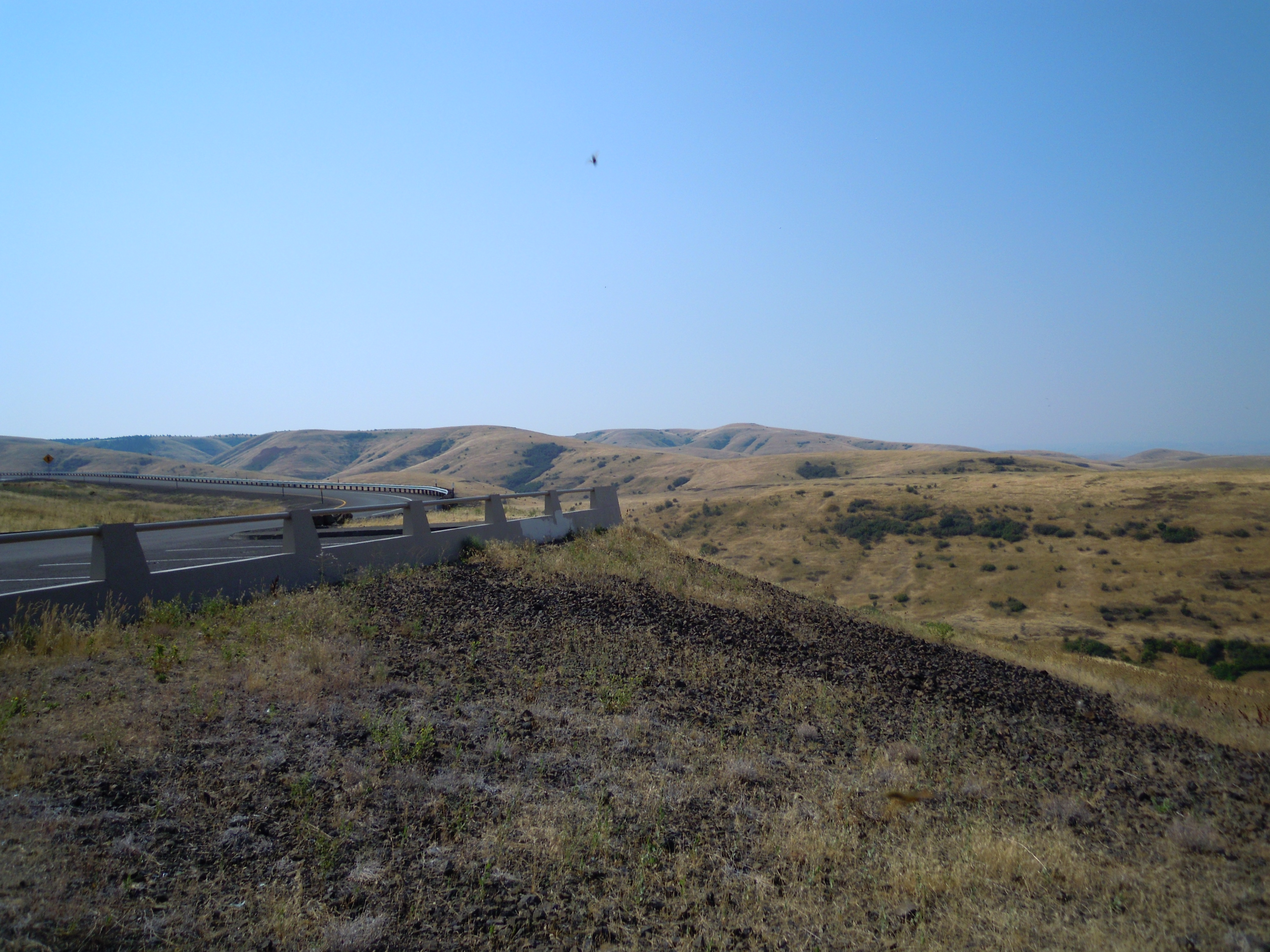
We got a late start on day three after a rocky night of sleep the night before when our neighbors in the motel made a little too much noise partying. I was reminded of complaints by some emigrants on the Oregon Trail concerned about Indian drums pounding all night, keeping them awake.

To add to our delay, we also had some trouble finding Fort Hall. But once we found it, we took our time to see this fine replica in Pocatello, Idaho.

Fort Hall became another milepost for the weary emigrants trekking across the Oregon Trail. It meant they had come about two-thirds of the way on this incredible journey. Although the fort may have become a little dilapidated, some found comfort in the presence of an actual man-made structure in this wilderness.

The tidy structure today is a replica, built a few miles from the original. The builders did their best to create an authentic reproduction, using plans maintained by the Hudson’s Bay Company. I had a nice chat with the staff people. A man I’d spoken to earlier by phone met me there, and I left them a copy of my book, A Place of Her Own, about my great-great-grandmother Martha Maupin who took that trek west with her husband and their two small daughters.

The original fort came into being somewhat by accident. Nathaniel Wyeth, an American businessman from New England, became interested in the fur trade sometime in the early 1830s. Wyeth visited the annual Rocky Mountain Rendezvous of mountain men, Indians, and traders in 1832. There he negotiated with leaders of the Rocky Mountain Fur Company, one of the American companies that took supplies from St. Louis to the mountains for that annual gathering where they would trade supplies for furs that trappers and Indians had collected during the year. Wyeth offered to bring trade goods to the 1834 rendezvous, hoping to do a good business.

429.palisades like wyeth's - cropHowever, the Rocky Mountain Fur Company had financial difficulties and didn’t accept Wyeth’s goods. With $3,000 worth of supplies on hand and no buyer, Wyeth decided to build a trading post, which he named Fort Hall.

He constructed a wooden fort with palisade walls like those shown here (on the right), put up a handmade American flag, and left a man to run the post.

The British Hudson’s Bay Company didn’t look so kindly upon this American intrusion in the territory they wanted to claim for themselves. They built another fort a few miles downriver, Fort Boise, and soon put Wyeth out of business. By 1837 Wyeth gave up and sold his fort to the HBC at a loss.

The HBC covered the palisade walls with adobe. The place was still in the hands of the HBC in 1850 when Martha saw it, but the HBC abandoned it in 1855 or 1856, according to the Fort Hall Replica website (link below). Butruille (cited below) indicates the U.S. took it over in 1855. However, a couple of diarists (above), writing in 1852, suggest a former U.S. military presence at the time they passed through. Writers of history often disagree, I’ve found, and the diarists may not have been aware of the fort’s history.

In any case, the original was eventually abandoned as it began to crumble, and bits and pieces were carted off for other uses. But residents of the area later decided to replicate it. Since they could not build on the original site they put the structure on a lovely rise in ground at Ross Park in Pocatello.

477.blacksmith shop ft hallChristiane and Calliope and I traipsed through the interior, where many rooms have been set up like the originals. In the above photo of the blacksmith shop you can see the large bellows for raising the fire’s heat, an anvil, and other equipment. A blacksmith shop would have been a welcome convenience for the travelers whose wagons were often in need of considerable repair after so many jolting miles.

We took our time exploring each room and imagining what it must have been like to see Fort Hall in its original state, its adobe walls looming boldly in this land of wild rivers and mountains and plains of sagebrush. It must have looked a little out of place. And yet for people longing for any suggestion of civilization, the sight could well have provided a moment’s sigh of remembrance.

It was almost noon when we left the fort, so we found a nice shady table in Ross Park and ate our lunch before going on our way. A pleasant stop, but we began to feel rushed as we thought of the long road to this night’s destination of Laramie on the far side of Wyoming. We weren’t even out of Idaho yet.

Women’s Voices from the Oregon Trail, Susan G. Butruille. (Boise, ID: Tamarack Books, 1993), pp. 187-189.
http://www.forthall.net/history/index.html

[The small photo of the palisade walls was taken at the replica of Fort Umpqua in Elkton, Oregon, near where Martha Maupin ultimately settled.]

NEXT: Soda Springs and the sagebrush plains of Wyoming

COMMENT

Backtracking the Oregon Trail #2

Day Two ~ The Blue Mountains

469.diorama oxen & wagon[The roads] were harder than before. Steeper. Rockier. Dustier. Rivers wilder. There was an occasional tree now, sometimes wooded areas even, with tall conifers and cottonwoods. . . . The trail here was littered with the bones of oxen and fresher dead beasts—along with discarded trunks and furniture—and another human grave. A chill raked Martha despite the heat. The smell of death assaulted her nose.
A Place of Her Own: The Legacy of Oregon Pioneer Martha Poindexter Maupin, Janet Fisher. (Guilford, CT, Helena, MT: TwoDot/Globe Pequot Press, 2014), p. 119.

Sep 3d We came, I think, eleven miles; over the mountains; the scenery was delightful all day but the road was extremely hilly and rough . . .
September 4th We came, I think, fourteen miles this day over the principal range of the Blue mountains, traveling all day through a densely timbered region . . .
—The diary of Abigail Jane Scott, in Covered Wagon Women: Diaries and Letters from the Western Trails, 1840-1890. Vol. 5, 1852, The Oregon Trail, Kenneth L. Holmes and David C. Duniway, eds. (Glendale, CA: The Arthur H. Clark Co., 1986), pp. 121-122.

3d Sunday . . . Traveled along the west side of the valley at foot of mount about 3 miles when we came to a small stream and then commenced ascending the mountain, very steep in many places and continues to ascend for about 6 miles. very hard drive but at the top found the grass burnt off and there was no water, so had to go on till we came to Grand Ronde [River], ten miles, worst hill to go down that we have found yet. long, steep and rocky. . . .
5th Tuesday . . . Hard times. many cattle are failing and all are very poor and a good many get lost among the thick timber. . . . Traveled on about 7 miles on a mountain ridge sometimes on one side sometimes on the other. pretty sidling in places . . . begin to hope we are getting out of the mounts.
—The diary of Cecelia Adams & Parthenia Blank, Covered Wagon Women: Diaries and Letters from the Western Trails, 1840-1890. Vol. 5, 1852, The Oregon Trail, Kenneth L. Holmes and David C. Duniway, eds. (Glendale, CA: The Arthur H. Clark Co., 1986), pp. 302-303.

Tues Sept 21 Traveled 20 miles. . . . Here we commence climbing the Blue Mountains. . . . Had to camp without water. Found hard hills to day and very stony. Saw 5 graves and 5 dead cattle.
—The diary of Martha S. Read, Covered Wagon Women: Diaries and Letters from the Western Trails, 1840-1890. Vol. 5, 1852, The Oregon Trail, Kenneth L. Holmes and David C. Duniway, eds. (Glendale, CA: The Arthur H. Clark Co., 1986), p. 245.

455.road uphill  blue mtsA formidable barrier loomed in front of us as we drove southeast from Pendleton, following the Oregon Trail pretty closely. Rising suddenly from a wide, flat landscape, the ridge looked barren except for a few tree clumps in the hollows. The highway took a wide sweep to zigzag up the hill. You could feel it on the heavily loaded car. Ears popped. My breath caught, imagining wagons rolling down this grade from the other direction.

We soon climbed into rugged timbered mountains. Mostly pines. And worked our way across, with lots of ups and down. Ridge after ridge. These were the Blue Mountains, the worst mountains the emigrants had crossed so far on their entire journey.

You don’t give much thought to those rising and falling grades while driving a car on a smooth highway—although we saw a few cars stopped with raised hoods. But when you let your thoughts drift back to a time when every rise meant a long, hard pull for weary oxen and every drop meant the danger of a wagon rolling out of control—forward or sideways. And every stone on a gravelly track meant the risk of losing a wheel or even overturning the whole vessel. Then the ups and downs become a whole lot more serious.

458.blue mts long view (crop)And think of where they were on that incredible journey. They were nearing the end. They’ve been trudging across a seemingly endless track for almost 2,000 miles. How daunting for them to reach the roughest part now. The oxen are so weary, many are just giving it up. Not enough food. Sore feet. Loads feeling heavier by the day. Now this. They drop and die. And sometimes people do too. Still, in their weariness, some diarists remarked on the splendid beauty of it. The fine timber.

After a long haul across this range we came alongside a gravelly creek which tumbled into a large flat expanse surrounded by a ring of mountains. Out ahead we could see where we would have to climb another ridge. This was the Grande Ronde Valley, admired by many travelers. The name comes from the French grande ronde, meaning “fine large valley” or “big round valley,” so named by the early French-Canadian trappers. A respite before the next rise. The Grande Ronde River mentioned in the above diary flows out of the Blue Mountains.

Our next climb brought us into sparse pine woods, which offered scattered shade amid jutting rock bluffs and scanty tufts of dry grass. This ridge wasn’t nearly as rugged or deep as the last. Reverse the direction of travel and you realize this was only a hint of worse to come for those westbound pioneers. Could they even imagine what was awaiting them in the ridge ahead?

[The photo at the top was taken in the National Historic Oregon Trail Interpretive Center near Baker City, Oregon]

NEXT: A stopover at the interpretive center just outside Baker City, a highlight on our journey

COMMENT


Backtracking the Oregon Trail #1

Introduction

I recently returned from a road trip with my daughter Christiane and granddaughter Calliope. Christiane got a new job as Assistant Professor at Kansas City Art Institute and was moving back to the Kansas City area. I decided to join her on the drive east to help with my granddaughter, who’s nine years old, then help set up their new house before flying home. On our eastbound route we chose to backtrack Martha’s journey over the Oregon Trail as roads and time allowed.

It took us five days to cross what took five months for my great-great-grandparents Martha and Garrett Maupin. And for my flight home I was in the air about five hours.

I’m adding this new category to my blog to describe our trip, offering related quotes from my book about Martha, A Place of Her Own: The Legacy of Oregon Pioneer Martha Poindexter Maupin, as well as quotes from the diaries of other pioneer women who made that journey. The diaries are taken from a series called Covered Wagon Women, edited by Kenneth L. Holmes. Like Holmes I present these diaries as written, using the spellings and punctuations of the original writers. A few additional sources add information. This is the first of ten posts in our story.

462.one lg wagonDay One ~ The Dalles

[T]he heat of the day radiated with scorching fury. . . . Now Martha worried about their own food supply. Her food bags had gone flabby for lack of contents. They’d traded with some Indians–shirts for fish–large dried salmon to add to the meat supply. But they were nearly out of flour. How long until they reached The Dalles, where they might buy more?
A Place of Her Own: The Legacy of Oregon Pioneer Martha Poindexter Maupin, Janet Fisher. (Guilford, CT, Helena, MT: TwoDot/Globe Pequot Press, 2014), pp. 119-120.

Here the Doct. met us on his way back from the Dalls. . . . He brought some flour, pork, Salt, and saleratus. Prices are coming down at the dalls. flour can be had at 15 cts. Pork at 37½, Salt at 25, Salertus 25, Sugar 25 to 30 . . . Have long been convinced that we are too late to cross the Cascade Mountains with safety so we concluded to leave our cattle and wagon at the Dalls and proceed down by water. . . . Traveled to the Dalls, 5 miles, and found a boat ready for sail
—The diary of Cecelia Adams & Parthenia Blank, in Covered Wagon Women: Diaries and Letters from the Western Trails, 1840-1890. Vol. 5, 1852, The Oregon Trail, Kenneth L. Holmes and David C. Duniway, eds. (Glendale, CA: The Arthur H. Clark Co., 1986), pp. 308, 310.

We this morning sent two of the wagons by the way of the Dalles to be sent to Oregon City by water
—The diary of Abigail Jane Scott, in Covered Wagon Women: Diaries and Letters from the Western Trails, 1840-1890. Vol. 5, 1852, The Oregon Trail, Kenneth L. Holmes and David C. Duniway, eds. (Glendale, CA: The Arthur H. Clark Co., 1986), pp. 129-130.

461.circle wagonsWe crammed everything into the car that we possibly could, to add to what Christiane had sent by U-Haul pod. Martha and Garrett crammed everything into the wagon they possibly could, and left behind anything that wouldn’t fit or that would be too heavy for the oxen to pull.

Starting out on the main roads, we planned to meet up with Martha and Garrett’s route at The Dalles, Oregon. The Dalles was one of those mileposts for the American emigrants, a place to replenish depleted supplies and to stop and rest before the most harrowing part of the journey. While the Rocky Mountains offered a gentle pass across their summit, the Cascade Mountains did not. The first several wagon trains in the early 1840s stopped well before this rugged range. Wagons were dismantled, broken down, left behind—either at The Dalles or before—and people took boats down the treacherous Columbia River or followed long, perilous trails on horseback over the mountains.

But wagons carried a lot of stuff they wanted. And getting those treasures to the west side without the wagons proved a problem. Some ferried the loaded wagon boxes down the river, or reloaded the goods onto boats. But many wanted to take the wagons west with them. Men decided to cut a road over the Cascades south of Mount Hood. They called it Barlow Road. Not much of a road, but hardy folks like the Maupins took their wagons across the Cascades over it, all the way to their destination in Oregon’s lush Willamette Valley. I had previously visited part of that route just prior to writing Martha’s story, so we bypassed that and went straight toward The Dalles.

We had talked about eating dinner at The Dalles, but were getting hungry before we got there. I couldn’t help being reminded of Martha’s concerns about their food supply before reaching The Dalles. We decided to stop for dinner at Hood River instead. The car has a temperature gauge, and had been warning us, but we were comfortable with the air conditioner blowing. The numbers had hit 98 in Portland, unusually high for that city, and reached 100 by Troutdale on the city’s eastern perimeter. At Hood River it had climbed to 102.

We stepped out of the car. Heat pressed down like a living force. We had Christiane and Calliope’s dog Penny with us. We couldn’t leave the dog in the car, even in the shade. Looking for a place where we could eat outside and tie her next to us, we finally found a possibility. The restaurant had tables on a covered patio and the waitress set a place for us—in the sun! No way could I sit in the sun to eat when it was 102 in the shade. Nor could they promise food in less than 30 to 40 minutes. I figured we’d be cooked ourselves in that amount of time.

Our thoughts of a nice dinner evaporated like water on a sizzling sidewalk. We pushed on to The Dalles. It was drive-through time. Eat in the car with an occasional blast of cool air from the AC.

464.two wagonsAgain I thought of Martha and the relentless heat bearing down on her, often without shade except for a little alongside the wagon. No blast of cool air from anywhere. How desperate she must have been for a tree, a stream of water, anything to provide relief. At least, here on the east side of the Cascades it was a dry heat. But when it’s over 100 it still takes your breath away.

Anyway, a quick dinner got us back on the road faster and we drove on toward our first night’s destination in Pendleton, Oregon. It had taken us longer than expected to load up that morning, and the estimated travel times we got online appeared to be a little optimistic. We wouldn’t reach Pendleton before dark. A sense of urgency compelled us. But with the long summer days, we saw most of our route, dark settling just before Pendleton so when we approached it, the town appeared like a jewel of lights nestled in dark velvet.

[The photos for this post were taken outside the National Historic Oregon Trail Interpretive Center in Baker City, Oregon, which we would visit on Day Two. All photos in the series are by the author.]

NEXT: First thing the following morning, we reach the Blue Mountains, the most difficult road the emigrants have seen on their entire journey.

COMMENT