
In the weeks prior to my July 16 reading and signing event at the historic Fort Vancouver site in Vancouver, Washington, I’ll be offering some background color in this new series I’m calling “The TRUE Shifting Winds.”
What sets my book The Shifting Winds apart from many historical novels of adventure and romance is the history. Yes, there’s a triangle love story, two men vying for one young woman, but there’s another triangle, two nations vying for one land. The winds of rivalry shifting back and forth in the fictional love story echo the true story of shifting winds between rivals Britain and America over the disputed Oregon Territory in the 1840s.
The Afterword of the book presents some of the actual history through which the story flows and several of the real people who populate it. In this new series of blog posts I want to delve deeper into that history. I hope these posts will enhance your reading of the book—or add perspective if you’ve already read it.
To start, let’s go way back, about 350 years before my story opens, to the events that led Europeans into this land of Oregon, at a time when the winds did shift aplenty.
River of the West
The winds of change in the true history of Oregon began to stir long before my characters walked onto the stage. The land had been settled by early tribes for thousands of years before even a whisper of its existence entered the minds of Europeans who had begun exploring the world in their improved sailing craft. Maps left no space for such a place. The coastline of what is now the state of Oregon was the last of the entire globe to be examined and charted by European navigators.
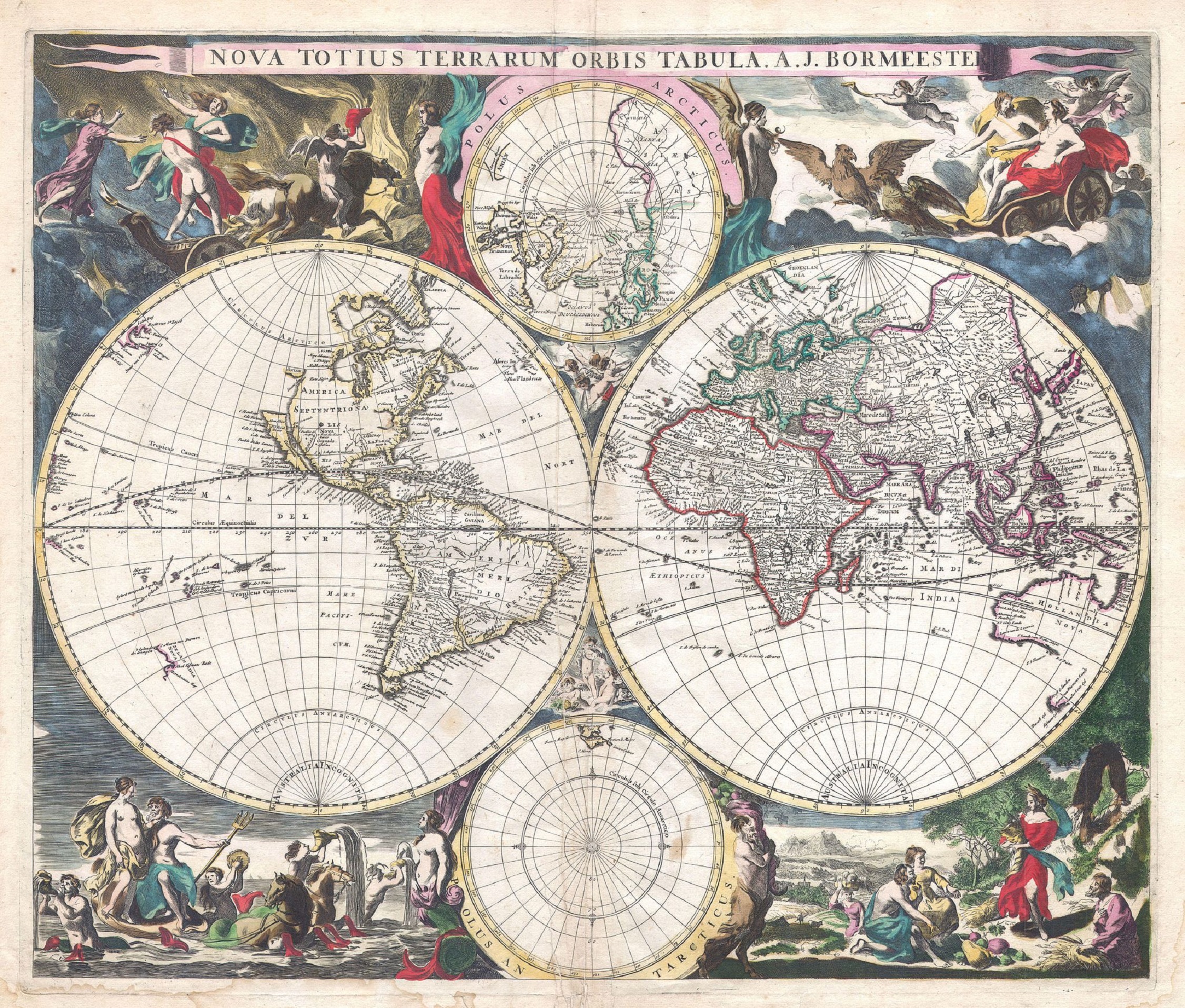
The above map provides one version of the world as envisioned in 1684 by Dutch map publisher Joachim Bormeester. From Geographicus. California is an island and the Pacific Northwest pretty much blank. But in the 1400s that whole left globe was an unknown, and a fair portion of the rest as well.
Shortly after Christopher Columbus sailed for India in 1492 and bumped into what would be called the Americas, the Catholic Pope chose to settle the rivalry of Spain and Portugal over rights of exploration by dividing the world between the two nations. He gave Spain a free field to the west and Portugal a free field to the east. And if their paths should cross, any land in the middle would be taken by right of discovery. The two nations agreed. Just like that. The whole world.
Studying the reports of Columbus, the Portuguese navigator Ferdinand Magellan thought he could reach the tasty bounty of the Spice Islands on his half of the world by sailing west and finding passage through this new land Columbus happened upon. But Magellan wasn’t on good terms with his own king, and when the Portuguese king refused him he petitioned the Spanish king instead. Under the Spanish flag Magellan led a fleet of five ships in 1518 in search of a passage but found no opening until he reached the far south, where he traveled through the strait that now bears his name and came around the Horn into new waters. Having just sailed through stormy seas he found the ocean to be refreshingly calm in that moment, and he called it the Pacific Ocean. Events would turn less peaceful. He was killed in a battle in the Philippines, and his other ships ravaged, but one ship limped back to Spain, the first to circumnavigate the globe.
With more knowledge of the world, the new pope issued another decree setting a new north-south line dividing Portugal and Spain at 37 degrees west—which is why people in Brazil today speak Portuguese, instead of Spanish like their neighbors. This decree and the early voyages by Spanish navigators would later be used by Spain to claim exclusive right to the Pacific Coast of North America.
But with the religious upheavals of the Reformation, papal authority weakened and Protestant nations defied the rights given to Catholic Spain and Portugal, demanding freedom of the sea. And they didn’t hesitate to relieve the Spanish and Portuguese of their plunder.
The dashing Sir Francis Drake, hero of Britain, may have visited the Oregon Coast on one of these raids against the Spanish, but his descriptions aren’t clear enough to say. He had first caught sight of the Pacific Ocean as a young man after trudging across the Isthmus of Panama, where he’d gone to raid a Spanish settlement in 1573.
Four years later Drake sailed around the Horn for his daring adventure to pillage Spanish ships in the Pacific, capturing so much gold and other booty his ships nearly sank with the treasure. At this point no one in Europe knew anything about Oregon. The colonies of Virginia and Massachusetts had recently been formed. California was believed to be an island, and Drake may have thought he could escape the angry Spanish by doing a run around the north side of California and taking a direct shot for the Atlantic and home. But the weather was so bad he turned back south with no exploration of the land for uncertain passages. He returned to England in 1580 by going back around the Horn.
For the next 200 years the British did nothing to secure the west coast. But in 1763 after the Seven Years’ War (French and Indian War in the US) Britain gained the Canadian colonies from the French and began exploring the western sea, sending out Captain James Cook of the Royal Navy to map the uncharted region.
The first known use of the name “Oregon” came in 1765 when Major Robert Rogers submitted a proposal to King George the Third, asking him to send an overland expedition to search for the elusive northwest passage believed to exist between the Atlantic and the Pacific. Roberts proposed to go from the Great Lakes to the Head of the Mississippi and from there to a “River called by the Indians Ouragon,” also called the River of the West, which flowed westward into the Pacific Ocean.
The expedition was not completed, but one of the partners in the venture, Jonathan Carver, later wrote a book about his travels in which he names the river “Oregon or River of the West,” so spelled in the published version. The name Oregon began to appear on maps to identify the river. Both Roberts and Carter claimed the name was of Indian origin, not a derivation of a French or English word as some scholars suggested. Lewis and Clark evidently found no tribes in the area using that name, and detractors point to its similarity with the French word ouragan, meaning “windstorm,” an apt reference for this river when its winds whip up. The French comingled with Native Americans throughout North America, and other tribes could have picked up on the reference. The controversy continues.

One of Jonathan Carver’s maps, above, published in the book of his travels in 1778 shows the “River of the West” on the west coast of North America. From the Library of Congress.
Captain Cook kept exploring by sea. On his third voyage into the Pacific he visited the Oregon Coast in hopes of finding the northwest passage, but he missed the mouth of this legendary River of the West. He had set sail for this third voyage on July 12, 1776, only a few days after the American colonists declared their independence. Just when he was hoping to benefit Europe with new discoveries, his nation was attempting to put down a revolution in one of their previous discoveries. Cook was killed on this journey in a fracas in Hawaii, but when his men returned home, word of fantastic trade possibilities leaked out.
China was offering high prices for furs from the Pacific Coast, which traders could obtain from the local tribes for simple trinkets, and the furs could be exchanged in China for tea and other Chinese goods to take to Boston for a fine profit. A Boston company was formed and sent out Captain John Kendrick and Captain Robert Gray in two vessels, the Columbia Rediviva and the Lady Washington. The fur trade era had begun.
The Spanish at this time considered the Pacific their own pond and the Pacific Coast of North America part of their domain. They were clearly suspicious of the US purpose in these waters. Kendrick and Gray, for their part, were instructed to keep the peace, but they had a few scrapes even so. During the venture Gray dared move his ship closer to the coastline than most ships and discovered many bays and inlets and promising streams. He returned to Boston in the Columbia Rediviva, the first US ship to circumnavigate the globe, and his company quickly refitted the Columbia, sending Gray back to the Pacific.
On May 11, 1792, Gray revisited a place he believed to be the mouth of a large river. He tried for days to enter the stream across a formidable bar, then finally sent a smaller craft to find a channel by sounding. When his men found what they considered a safe channel he crossed the bar into a great wide river. The local tribesmen met him with excitement, having never seen such a craft come into their waters, and Gray knew he had made a significant discovery. Was this the River of the West? The Oregon? The northwest passage? Perhaps. He named the river the Columbia after his ship.
Gray sailed upriver a ways, went aground, then drew free again, finally leaving for the sea after nine days. Sailing up the coast he approached the British Captain George Vancouver, who was also exploring the area. Gray told Vancouver about his discovery, and Vancouver sailed south along with another British vessel commanded by Lieutenant William Broughton to check out what Gray had found. Vancouver’s ship being too large to cross the bar, he dispatched Broughton with the smaller of their two vessels. Broughton sailed up the river about 120 miles, considerably farther than Gray, but Vancouver graciously credited Gray with the discovery and accepted the name Columbia.
London would later use Broughton’s journey into the river as part of their claim to the country. And when Dr. John McLoughlin chose the site for the Hudson’s Bay Company’s western headquarters he noted the location to be within this stretch sailed by his countryman Broughton, just downriver from the height of Broughton’s excursion on the river. McLoughlin named the fort for Broughton’s superior officer, Vancouver.
As the River of the West became the Columbia, the name Oregon gradually came to refer to the region surrounding this great river.
Sources:
Carey, Charles H., LLD. General History of Oregon: Through Early Statehood. Portland, OR: Binfords & Mort, 1971.
Various websites
NEXT: Fur Traders
