My presentation in the Visitor Center at Fort Vancouver is just two days away, Saturday, July 16, and with this post I will close out the “TRUE Shifting Winds” series. The event starts at 2 pm, when I’ll give a talk while showing photos related to my book and the fort. I’ll do a couple of short readings from the book, selected from scenes at the fort, and after some Q&A, sign books.
The Visitor Center bookstore will have copies of The Shifting Winds for sale, and also my first book, A Place of Her Own, the story of my own great-great grandmother who came west over the Oregon Trail.
Following the signing I’ll invite attendees to go down to the fort where I’ll lead a tour of places that appear in The Shifting Winds, accompanied by Mary Rose, Executive Director of the Friends of Fort Vancouver. There’s a small fee to get into this National Park Service site, or if you have your own pass, that will work too. If you’re in the vicinity I hope you’ll join us for this walk into the past.
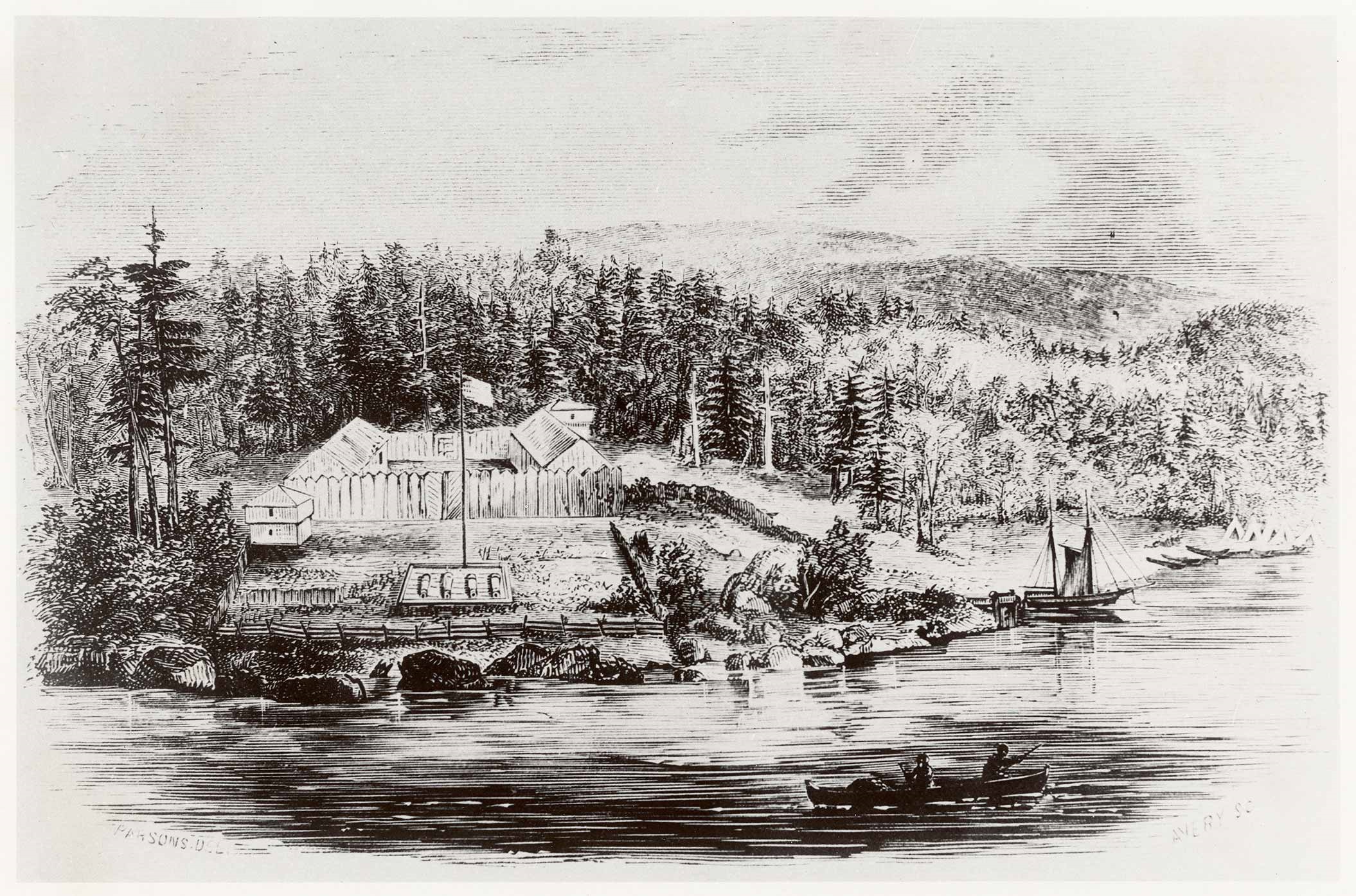
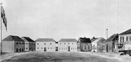
A Reconstructed Fort
Making the past live. Isn’t that what historical novelists do? Make the past live? We try. So we have something in common with those who worked so hard to bring structures and their contents back to life at Fort Vancouver. Even staff members put on the garb and help draw visitors back to an earlier time. And the rangers tell the old stories, like bards.
We historical novelists tell the old stories through the eyes of our fictional and sometimes historic characters. For my part I’ll refer you to my book, The Shifting Winds, with its scenes in the Big House shown above, the Old Office, and the Bachelor’s Quarters, as well as the fort grounds and the dark orchard behind the stockade on a cold night.
Here in my post I offer photos taken on my recent visit to the fort—for illustration—with a little text and tidbits of history to enliven them.
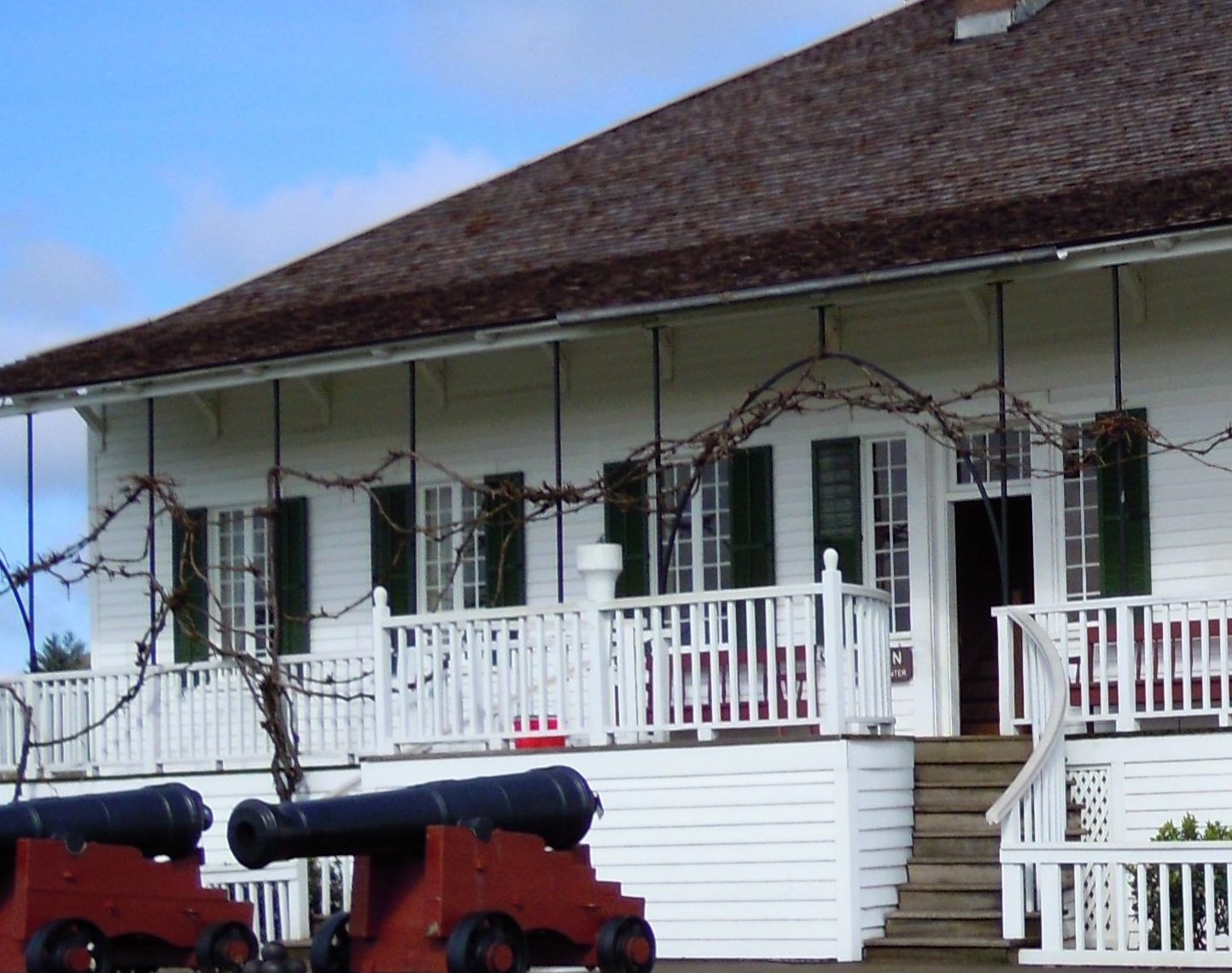
The Big House
The preservation team didn’t have blueprints for the house. They knew what the outside looked like from pictures, but for the inside their only clues were snippets of descriptions and comparisons with managers’ houses at other HBC forts, plus the remains found by archeologists–footings, the base of the chimney, evidence of a cellar.
The cellar probably held the oft mentioned wine and spirits served in the Mess Hall.
Gentlemen of the fort ate in the dining room in the Big House, generally called the Mess Hall, making this the center of business as well as social life. Everyone welcomed the arrival of visitors who brought news from other places, breaking the monotony of this isolated post. Many guests–distinguished and not–enjoyed the fine fare, even including soft loaf bread from the fort bakery, along with vegetables from the gardens, game from the hills, fish from the river, and eventually beef when herds grew large enough.
The well-stocked kitchen stood behind the house, connected by a passageway but separate for fire safety. Gentlemen maintained careful military etiquette as to rank, although Chief Factor McLoughlin could use his discretion to make allowances for some, especially Americans, whose rank might be obscure.
The officers of the fort offered the finest hospitality to keep visitors there as long as possible, although some of the gentlemen in the Bachelor’s Quarters, or even the office, might have to give up their rooms to house the guests.
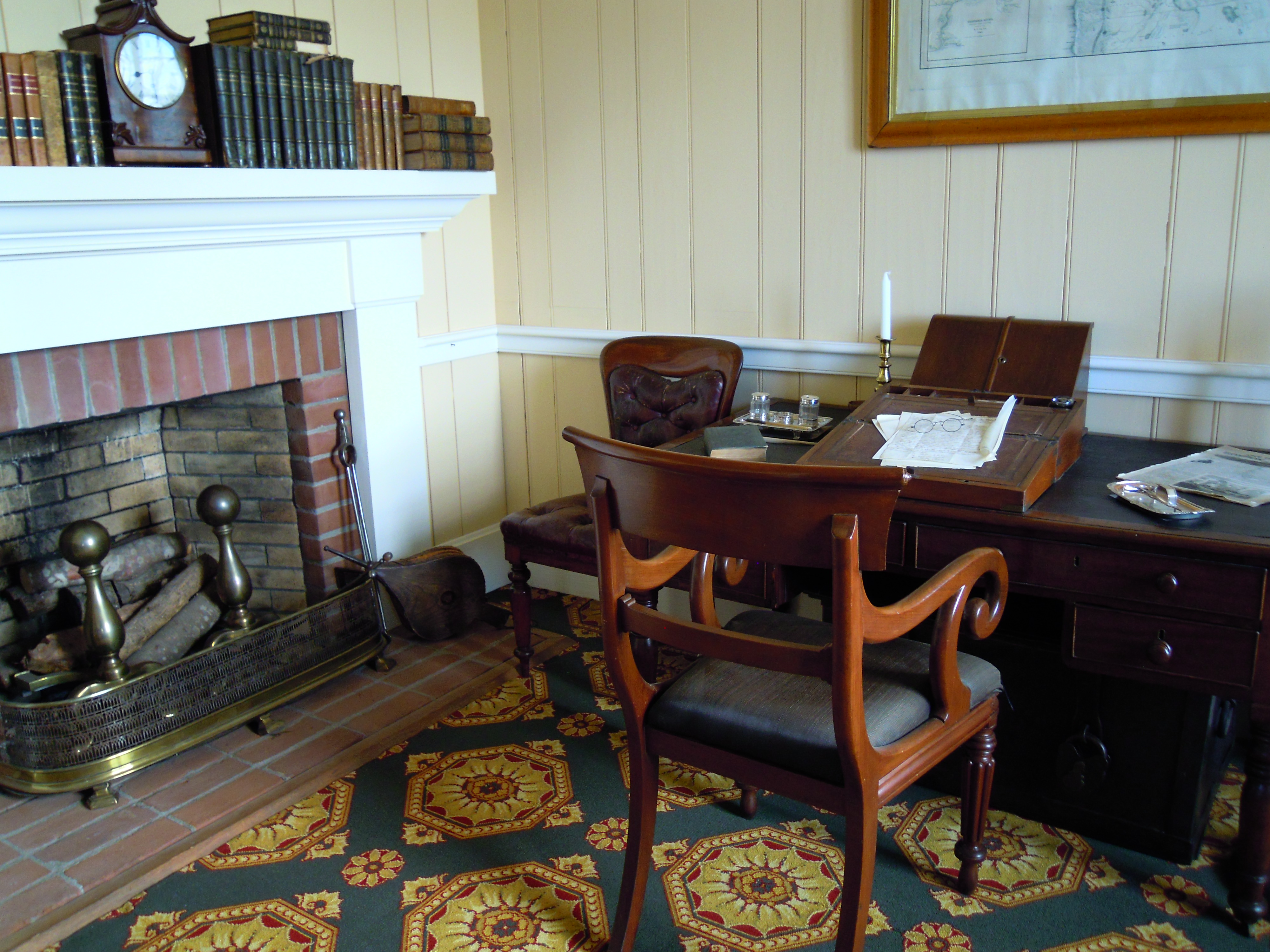
The McLoughlin sitting room, shown above, would be the place where Mrs. McLoughlin took her meals, sometimes with family and friends. Female guests with some status stayed in the Big House, like protagonist Jennie in my story, and she would have eaten her meals here with Mrs. McLoughlin. Only if the doctor missed mealtime in the Mess Hall might he join them. Update: The reconstructed house also has a small dining room for the women on the east side, which would have provided another option for them, but they would not eat in the Mess Hall with the men. That was strictly a male sanctuary.
Most of the women, like Marguerite McLoughlin were at least half Native American. Her mother was Cree. The women wore European dress, but with moccasins and deerskin leggings for riding gentleman fashion, that is, astride.
People who saw the McLoughlins together often commented on the fondness they showed for each other, although some had trouble accepting fur trade marriages. One man made such a fuss, McLoughlin struck him with his gold-headed cane, later apologizing for his outburst. Soon afterward McLoughlin insisted on a civil marriage, and when he later returned to his Catholic faith, the couple was married again in a Catholic ceremony–by then thoroughly wed.
Johnson in his book John McLoughlin comments: “The deference that Mr. McLoughlin showed to his wife in public was the envy of all American wives, who lost no time in citing him to their husbands as an example worthy of emulation.”
McLoughlin’s second-in-command, James Douglas, lived in the other half of the Big House for a time. The rich red of this room is based on a later detailed study conducted to determine the actual colors of rooms at the fort.
Researchers perused books on the subject, visited other forts and inspected bits of painted wood and brick dug up by archeologists on the individual building sites.
In their 2003 report they explain that this red was found on the east side of the building.
Historians believe the east half was the side where the Douglas family lived, so the Douglas sitting room was painted red, a color gaining new popularity at the time.
Beige painted scraps were found on the opposite side, leading to the painting of the McLoughlin sitting room beige, a more conservative color, perhaps reflecting the doctor’s preference. The most common color found was green toward the back of the house, and that was interpreted as an appropriate color for the Mess Hall, the largest room on the main floor. Chair rails were common with the top sometimes painted the same as the bottom, sometimes not. Ceilings were usually white.
Bedrooms tended to be in soft, pale colors.
Dr. McLoughlin’s personal office, shown above, could be accessed from the McLoughlin sitting room, continuing the same rug design and wall color. His office can also be accessed from the main entryway of the house, on your left as you step in the door. A steep staircase rises directly ahead of the front door.
Some question arose as to the location of the ballroom cited in a number of writings of the time. One remarked: “had a ball in evening upstairs.” Could that have been the Mess Hall, up the long curving outdoor staircase to the veranda? Or would it be upstairs in the ample space between the main floor and the structure’s high roof? The Mess Hall could be the location of parties. Or perhaps a large hall in the long Bachelor’s Quarters.
Hussey in his report seems to lean toward the second story, despite the apparent lack of windows, and I happily adopted the site for the Christmas Ball. Unfortunately that room isn’t open to the public. Still, I had no trouble imagining it. Who needs much description of a vast room when you have candlelight and violin music and swirling dancers in grand ball gowns and dress coats and sparkling eyes?
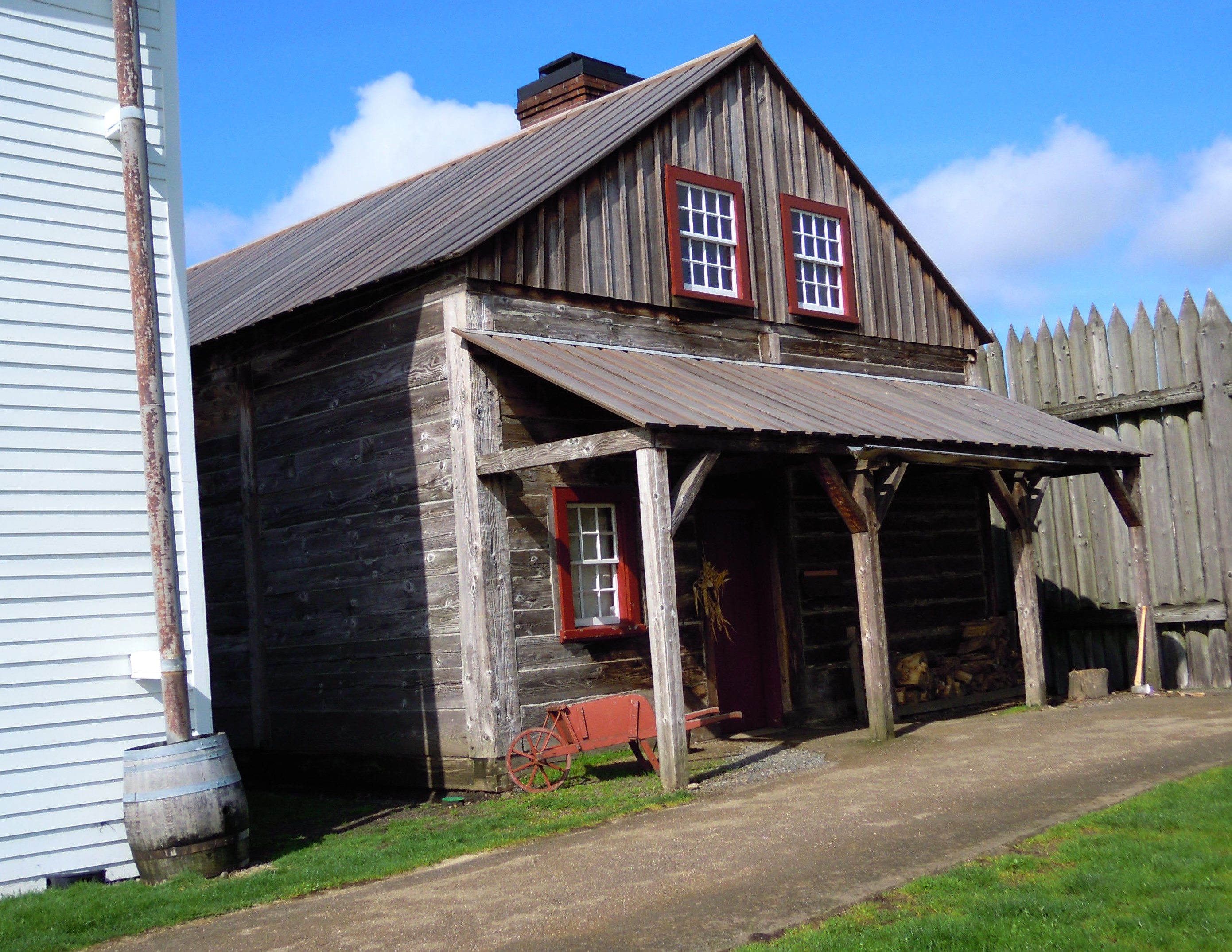
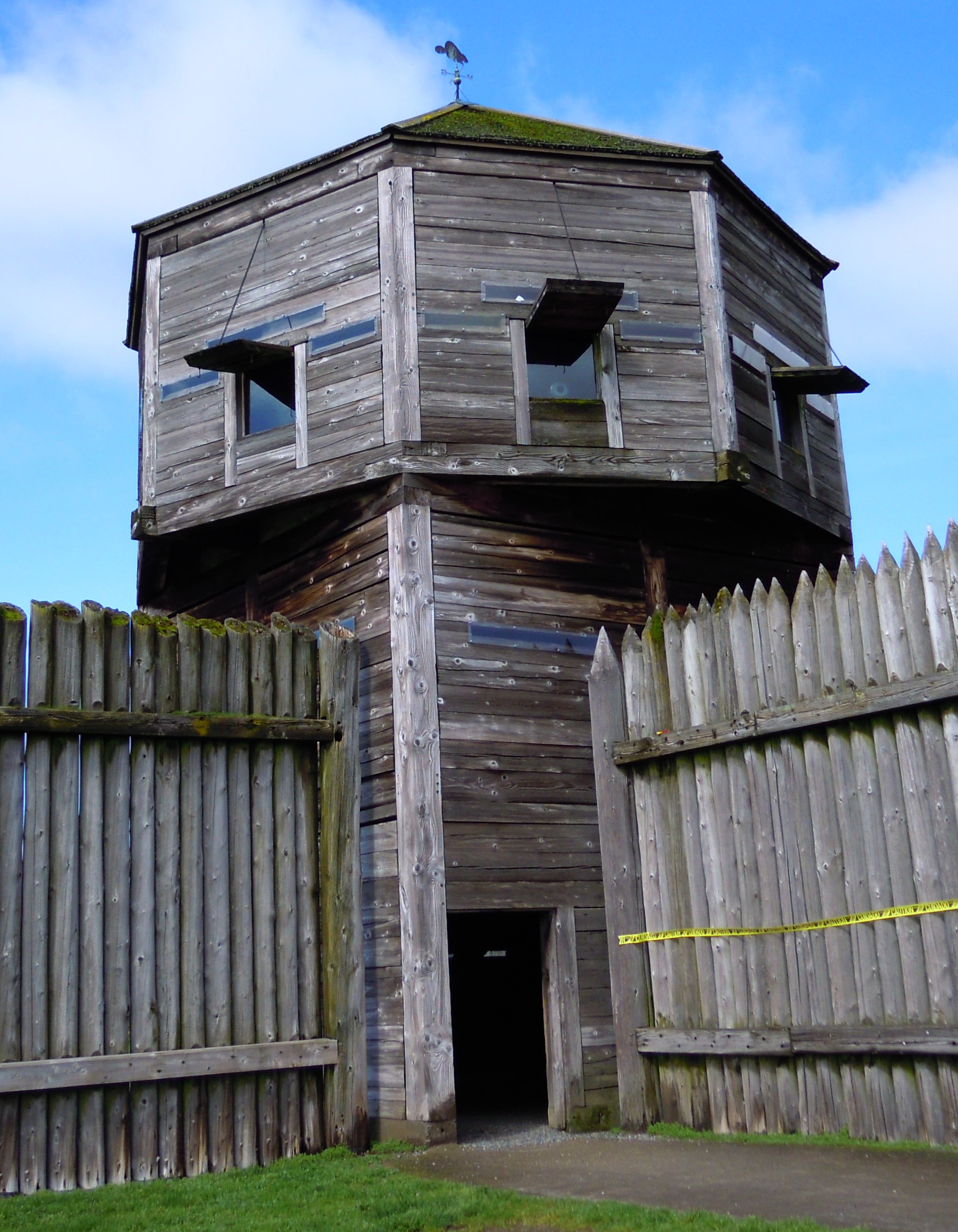
The Bachelor’s Quarters
This long structure hasn’t been reconstructed yet, so I’ll let my character Jake give you a word picture for that from the pages of The Shifting Winds:
Jake glanced around the stark little room a Company officer had been compelled to give up for him. Company gentlemen might dress well, but they didn’t live so well. A small bed, a simple chest of drawers, a tiny table with a box for a chair, one trunk. That was it for furnishings. A few mementos hung on the walls—tomahawks, feathers, carvings, a couple of paintings.
Like most of the fort buildings, the Bachelor’s Quarters were constructed in the Canadian post-on-sill fashion with sills of heavy, square-sawn timbers lying horizontally between upright grooved posts. Not a bit of paint on the unlined walls. But they did have glass windows.
He peered through the glass at the Big House where they were holding tonight’s party.
The Office
As noted in my last post, only the New Office has been reconstructed, although the Old Office may yet be built because it still stood on the fort grounds in 1845, even after they completed the new. The clerks couldn’t move into the new one because the captain of a visiting ship had taken up residence there.
The New Office can be seen now from the veranda of the Big House, but another building would have partially blocked the view.
The office was the domain of my character, the handsome clerk Alan Radford. I have a scene there when he invites protagonist Jennie to see where he works, offering her a glimpse of his life. He might have worked at a desk like the one, below, part of the furnishings in the reconstructed New Office. Another brief word picture from The Shifting Winds:
“So,” Alan said with a sweeping gesture to embrace the room, “my quarters, my place of work, and the hub of business at Fort Vancouver. What do you think?”
Caught up in his enthusiasm, she laughed. “It looks very . . . businesslike.”
Stark, but neat and orderly, the room had only two tall desks surrounded with several tall stools, the desks piled with books and ledgers and paper tidily stacked, ink bottles and rulers and pens beside them. . . .
Alan took her arm and led her to one of the desks. Laying a hand on the desktop, he gave her a warm smile. “My desk. I spend a lot of time here.”
He lifted a large black book and handed it to her. “Journals. We have to keep daily journals of everything that happens around here—what the men are doing, what the weather is like, who comes and goes.” He raised his brows, eyes alight. “You yourself will be in here, my dear. . . . You know, we almost have to see into the future here when we make our indents.”
“What are indents?”
“Our requests for supplies. The whole process takes so long that—well . . . here it is the end of 1842, and the lists we make now are for the year 1846.”
“Really? Why?”
His eyes smiled, and he swept one arm wide, his voice suddenly charged with drama. “It pleases me you want hear of my travails, m’lady.”
She laughed at his pretense and went along with it. “Kind sir, I want to know everything about you.”
“Ooh. That’s rich. Are you quite sure, m’lady, that you want to know it all?”
More Glimpses of the Past
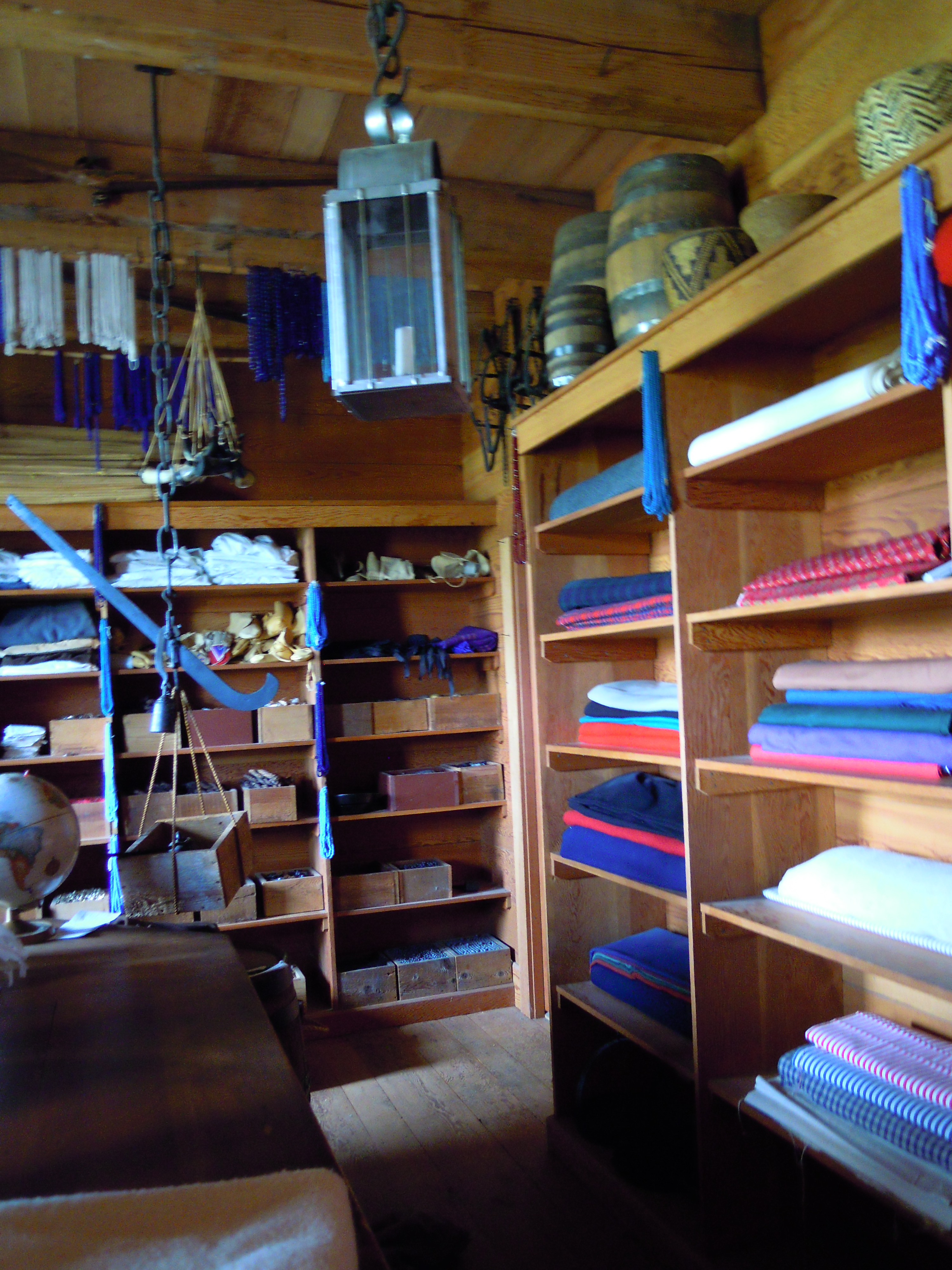
From the front door of the Big House you can look out on the working Blacksmith Shop at left and the well-stocked Indian Trade Store, straight ahead. And you can visit the Blacksmith Shop and Trade Store (shown below).
As noted in the previous post the Indian Trade Store was moved to this location sometime after my story. At the time of my story it was located across the grounds to the west. Update: Or maybe not. During the Saturday tour with Dr. Bob Cromwell, Chief Ranger and Archeologist, Dr. Cromwell said that the Indian Trade Store had already moved to this new location by the time of my story. Hussey puts the changeover as “sometime between July 1841 and December 1844.” With my story landing right in the middle I had interpreted the location to be as it was in 1841. The reconstruction, set at 1845, could easily locate it for their purposes.
The Fur Store, shown above, stands on that spot today. Update: The Fur Store may have already been in this location at the time of my story (see above).
These are some of the places we’ll see on Saturday when we tour the post, getting a glimpse into a past where people from my book walked, while stepping on ground where a historic character from the book actually trod, the fascinating Dr. John McLoughlin. And so through the creation of story and re-creation of this wonderful fort we endeavor to make the past live.
Thank you for joining me here. If you can, I hope you’ll join me at the fort.
Sources:
Fisher, Janet. The Shifting Winds. Guilford, CT, Helena, MT: TwoDot, Globe Pequot Press, Rowman & Littlefield, 2016.
Hussey, John A. Historical Structures Report Historical Data, Vol. I and II. Denver Service Center, National Park Service, U.S. Department of the Interior, 1972, 1976.
Johnson, Robert C. John McLoughlin: “Father of Oregon.” Portland, OR: Binfords & Mort, 1958.
Langford, Theresa, Scott Langford, and David K. Hansen. Paint at Fort Vancouver National Historic Site: Historical and Archaeological References for Interpretation and Reconstruction. Vancouver, WA: Department of the Interior, National Park Service, Fort Vancouver National Historic Site, 2003.
COMMENT


